PhD Student in the Rodriguez Coastal Geology Lab

UNC Chapel Hill Earth, Marine, and Environmental Sciences

About me

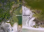
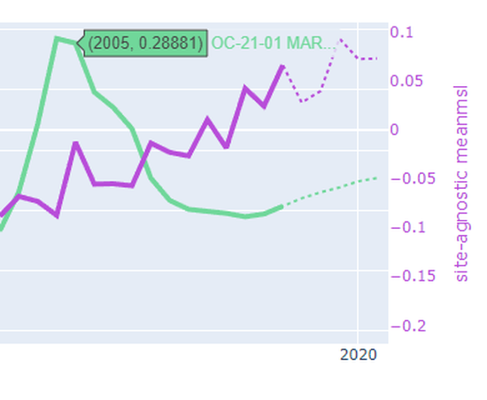
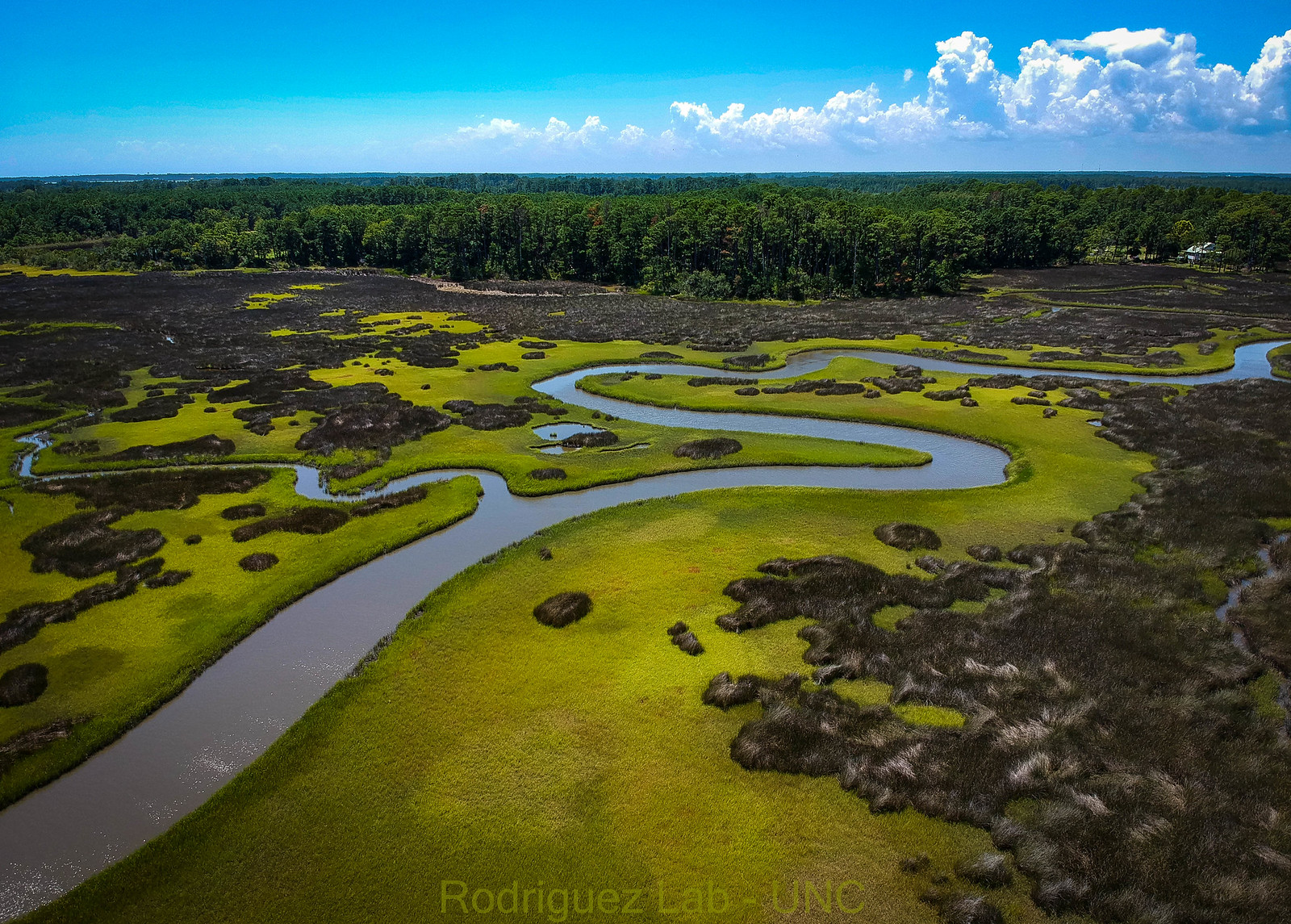
I am PhD Candidate in the Rodriguez Lab as part of the Earth, Marine, and Environmental Sciences department at the University of North Carolina at Chapel Hill. My research explores changes in the earth’s surface over timescales we can observe in our own lives; days to years. By tracking the origin and fate of sediments carried by rivers, tides, and storms, I aim to explain why saltmarshes, barrier islands, and oyster reefs reside where do. I enjoy linking datasets across spatial scales — from 10 centimeter wide sediment cores up to 100 kilometer wide satelite images — to help answer these questions. I collaborate with colleagues who use these data to forecast which systems seem stable and which are at risk. If all of that sounds like a lot, just know I make pretty figures.

Beyond research, you might find me flying a drone, running or backpacking, cooking with others, or teaching hands-on science.

Interests

  • Landscape change in the Anthropocene
  • Remote Sensing
  • Scientific communication and education

Education

  • PhD Student, 2020-

    UNC Chapel Hill

  • BSc in Geology and Environmental Sciences, 2018

    The College of William and Mary

  • Summer Coursework in Entrepreneurship, 2015

    Washington University in St. Louis

Recent Publications

Washout Versus Washover: Distinct Trajectories of Barrier Reshaping

Understudied barrier washout features persist as sub-tidal erosional scours for years after formation, offsetting landward movement, When elevations are low, high-water events not associated with named storms deliver large volumes of sediment to the subaerial barrier, Modeled rather than measured water levels correlated with volume change, suggesting runup overwash drove deposition over inundation
Washout Versus Washover: Distinct Trajectories of Barrier Reshaping

Widespread Amazonian dark earth in the Xingu Indigenous Territory

Using satellite imagery and classifiers trained on ground-truthed data collected by the Kuikoru people, we find that ~4% of the Xingu Indigenous Territory is composed of ‘Terra Preta’ - dark earth enriched in carbon by past human activity. This work refines carbon sequestration estimates in the Amazon while revealing sites of archaeological and cultural significance; sites that should be prioritized through conservation efforts.

3D structural metrics using UAV and LiDAR

Results indicate that UAS photogrammetry can produce robust oyster reef structural metrics that can be highly useful in oyster conservation and restoration.

Mechanisms of Pond Expansion in a Rapidly Submerging Marsh

Our observations from a rapidly submerging marsh in the Chesapeake Bay, United States suggest that the mechanisms and rates of pond expansion change with pond size., and depend on surrounding marsh health

Onset Fragmentation of Salt Marshes

We find the threshold for marsh fragmentation scales primarily with tidal range and that sediment supply is only relevant where tides are sufficient to transport sediment to the marsh interior.

Experience


PhD Student

Rodriguez Marine Geology Lab

Jun 2020 – Present North Carolina
  • Use high-resolution age-depth modelling of sediment cores to recreate depositional histories
  • Build low-cost turbidity sensors to track contemporary suspended sediment gradients
  • Map coastal systems using drone-based photogrammetry
  • Model water levels to relate to barrier island storm recovery


Interim Researcher

Perron Lab at MIT

Jan 2020 – Jun 2020 Massachussets
  • Used machine learning in Google Earth Engine to identify spectrally distinct rainforest canopies
  • Refined Terra Preta anthrosol distributions in Amazon rainforest


Science Lab Teacher

Peace Corps

Aug 2018 – Dec 2019 Liberia
  • Taught 10th and 11th Grade Physics and Biology courses
  • Organized experiential hands-on learning labs
  • Facilitated teacher training workshops


Research Technician

Kirwan Lab at VIMS

Oct 2015 – May 2018 Virginia
  • Designed and conducted research on patterns of marsh drowning
  • Aided in deployment and monitoring of turbidity sensors

Projects

*

Interactive Sediment Plot

Correlations between Marsh Edge Sedimentation and Environmental Variables

Measuring Turbidity on Marshes

Using open source turbidity sensors to monitor sediment delivery to varied saltmarsh settings

Evolution of Barrier Island Ponds

Tracking changes in Barrier Island geomorphology over a year on North Core Banks, NC

Effects of Increasing Coastal Sediment Loads on Tidal-creek Levee Morphology

Why do two adjacent environments (creeks and marshes) respond to sediment loading in different ways?

Phillips Island Map

A orthomosaic of Phillips Island for UNC’s planning purposes

IMS 3D Model

Interactive 3D Model of the Institute of Marine Science

Life in Liberia

Blog on my time teaching science with the Peace Corps in Liberia

Mechanisms of Pond Growth on Marshes

Undergraduate Honors Thesis at William and Mary

Media

*

Popular Mechanics

Scientists Uncovered the Amazon’s Secret Dark Earth

New Scientist

Amazon soil may store billions more tonnes of carbon than once thought

Queen City News

Longform news video on marsh migration

UNC Endeavors

Mucking in the Marshes

ABC 12 - Rip Currents

Brief Rip Current Advisory

Seagrant and APNEP Fellowship

Using open source turbidity sensors to monitor sediment delivery to varied saltmarsh settings

AGU / Quillette

Written Article by Daniel Lelchuk - “Want to Restore Your Faith in Humanity? Visit a Scientific Conference”

Contact